 vesseltracker.com
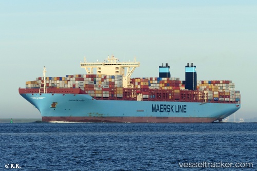
Margrethe Maersk
Current StatusWhere is the vessel?
Margrethe Maersk is currently in 30 nm S of Faro, based on AIS data received less than 1h ago.
Latest AIS update:
Current position: 36.52173° N, 7.89753° W (30 nm S of Faro)
Average speed (last 7 days): Loading…
Average speed (last 30 days): Loading…
Vessel profile: Margrethe Maersk is a Container Ship with dimensions 60m x 399m.
This page combines live AIS, route history, probable destination signals, nearby traffic, and port activity for practical vessel monitoring.
The current position of vessel Margrethe Maersk is 36.52173 lat / -7.89753 lng. Updated: 2026-04-07 21:24:52 UTCNearest reference points:
- 42 nm S of Faro
- Near Olhão
- Near ALBUFEIRA
Details:
Live Vessel Margrethe Maersk Analytics (details, animations, etc.)
Recent AIS points (UTC):
2026-04-07 15:22:42 UTC · 36.55110, -9.24087 · SOG 12.7 kn · COG 103°2026-04-07 17:46:32 UTC · 36.51108, -8.69191 · SOG 10.5 kn · COG 89°
2026-04-07 20:13:42 UTC · 36.53282, -8.15755 · SOG 10.6 kn · COG 91°
2026-04-07 21:24:52 UTC · 36.52173, -7.89753 · SOG 10.7 kn · COG 96°