 vesseltracker.com
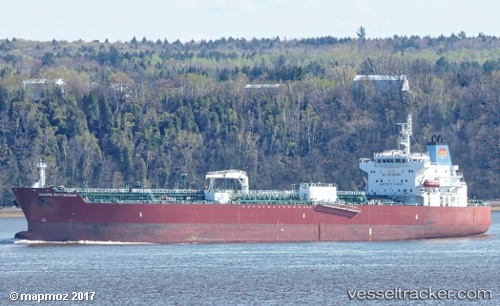
 TORM DORIS
Current Status
Where is the vessel?
TORM DORIS is currently in 127 nm E of San Andrés, based on AIS data received less than 1h ago.
Latest AIS update:
Current position: 12.46433° N, 79.53691° W (127 nm E of San Andrés)
Average speed (last 7 days): Loading…
Average speed (last 30 days): Loading…
Vessel profile: TORM DORIS is a Tanker with dimensions m x m.
This page combines live AIS, route history, probable destination signals, nearby traffic, and port activity for practical vessel monitoring.
The current position of vessel TORM DORIS is 12.46433 lat / -79.53691 lng. Updated: 2026-04-18 16:13:48 UTCNearest reference points:
- 62 nm NE of Playón Chico
Currently sailing under the flag of Denmark ![]()
Details:
Live Vessel TORM DORIS Analytics (details, animations, etc.)
Recent AIS points (UTC):
2026-04-18 09:13:33 UTC · 14.09186, -79.31340 · SOG 14.6 kn · COG 186°2026-04-18 12:21:14 UTC · 13.36128, -79.40483 · SOG 13.5 kn · COG 188°
2026-04-18 13:06:58 UTC · 13.19008, -79.43094 · SOG 13.5 kn · COG 186°
2026-04-18 16:13:48 UTC · 12.46433, -79.53691 · SOG 13.9 kn · COG 186°