 vesseltracker.com
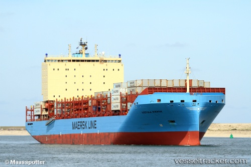
 Vistula Maersk
Current Status
Where is the vessel?
Vistula Maersk is currently in Near Saint-Siméon, based on AIS data received less than 1h ago.
Latest AIS update:
Current position: 47.70657° N, 69.93470° W (Near Saint-Siméon)
Average speed (last 7 days): Loading…
Average speed (last 30 days): Loading…
Vessel profile: Vistula Maersk is a Container Ship with dimensions 200m x 36m.
This page combines live AIS, route history, probable destination signals, nearby traffic, and port activity for practical vessel monitoring.
The current position of vessel Vistula Maersk is 47.70657 lat / -69.93470 lng. Updated: 2026-04-20 04:02:31 UTCNearest reference points:
- Near Ile Aux Coudres
- 15 nm NW of Saint-Anaclet
- Near QUEBEC
Currently sailing under the flag of Denmark ![]()
Details:
Live Vessel Vistula Maersk Analytics (details, animations, etc.)
Recent AIS points (UTC):
2026-04-20 01:18:19 UTC · 46.99958, -70.79665 · SOG 17.7 kn · COG 34°2026-04-20 01:35:02 UTC · 47.07148, -70.72975 · SOG 18.9 kn · COG 25°
2026-04-20 03:45:32 UTC · 47.63573, -70.02690 · SOG 20.8 kn · COG 39°
2026-04-20 04:02:31 UTC · 47.70657, -69.93470 · SOG 19.6 kn · COG 37°