 vesseltracker.com
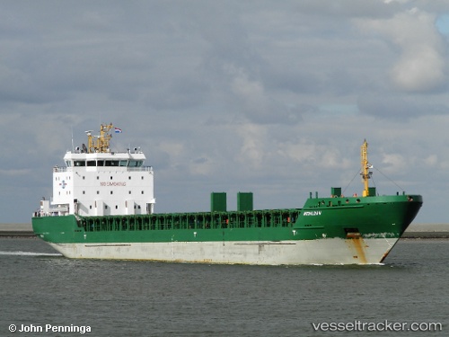
 Sua
Sua
Current Status
Where is the vessel?
Sua is currently in Near Cueva Bermeja, based on AIS data received about 2h ago.
Latest AIS update:
Current position: 28.43867° N, 16.22734° W (Near Cueva Bermeja)
Average speed (last 7 days): Loading…
Average speed (last 30 days): Loading…
Vessel profile: Sua is a Multi Purpose Carrier with dimensions 119m x 119m.
This page combines live AIS, route history, probable destination signals, nearby traffic, and port activity for practical vessel monitoring.
The current position of vessel Sua is 28.43867 lat / -16.22734 lng. Updated: 2026-04-12 11:39:27 UTCNearest reference points:
- Near San Nicolás
- Near Las Galletas
- Near LOS CRISTIANOS
Currently sailing under the flag of Spain ![]()
Sua built in 2009 year
Deadweight:
6797 tDetails:
Live Vessel Sua Analytics (details, animations, etc.)
Recent AIS points (UTC):
2026-04-12 07:06:26 UTC · 28.31717, -17.25096 · SOG 17.3 kn · COG 128°2026-04-12 08:17:51 UTC · 28.09383, -16.95571 · SOG 17.2 kn · COG 128°
2026-04-12 10:32:10 UTC · 28.14479, -16.37781 · SOG 16.8 kn · COG 31°
2026-04-12 11:39:27 UTC · 28.43867, -16.22734 · SOG 17.8 kn · COG 23°