 vesseltracker.com
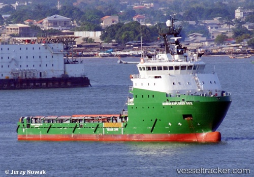
Bourbon Explorer 502
Current StatusWhere is the vessel?
Bourbon Explorer 502 is currently in Near Baobab Terminal, based on AIS data received less than 1h ago.
Latest AIS update:
Current position: 4.92421° N, 4.49109° W (Near Baobab Terminal)
Average speed (last 7 days): Loading…
Average speed (last 30 days): Loading…
Vessel profile: Bourbon Explorer 502 is a Offshore Tug Supply Ship with dimensions 17m x 78m.
This page combines live AIS, route history, probable destination signals, nearby traffic, and port activity for practical vessel monitoring.
The current position of vessel Bourbon Explorer 502 is 4.92421 lat / -4.49109 lng. Updated: 2026-04-13 13:44:05 UTCNearest reference points:
- Near Espoir
- Near Vridi
- Near Abidjan
Details:
Live Vessel Bourbon Explorer 502 Analytics (details, animations, etc.)
Recent AIS points (UTC):
2026-04-13 08:24:09 UTC · 4.91333, -4.48333 · SOG 0 kn · COG -1°2026-04-13 10:03:46 UTC · 4.91242, -4.48339 · SOG 0.5 kn · COG 241°
2026-04-13 11:57:25 UTC · 4.91846, -4.48644 · SOG 0.8 kn · COG 50°
2026-04-13 13:44:05 UTC · 4.92421, -4.49109 · SOG 1 kn · COG 50°