 vesseltracker.com
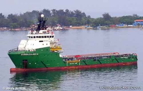
Bourbon Explorer 512
Current StatusWhere is the vessel?
Bourbon Explorer 512 is currently in 13 nm W of Saxi Batuque FPSO, based on AIS data received less than 1h ago.
Latest AIS update:
Current position: 6.29574° S, 11.00246° E (13 nm W of Saxi Batuque FPSO)
Average speed (last 7 days): Loading…
Average speed (last 30 days): Loading…
Vessel profile: Bourbon Explorer 512 is a Offshore Tug Supply Ship with dimensions 17m x 78m.
This page combines live AIS, route history, probable destination signals, nearby traffic, and port activity for practical vessel monitoring.
The current position of vessel Bourbon Explorer 512 is -6.29574 lat / 11.00246 lng. Updated: 2026-04-19 12:22:11 UTCNearest reference points:
- Near N'Kossa Terminal
- 11 nm W of Cabinda
- Near SOYO
Details:
Live Vessel Bourbon Explorer 512 Analytics (details, animations, etc.)
Recent AIS points (UTC):
2026-04-19 07:32:00 UTC · -6.30545, 11.06645 · SOG 3 kn · COG 31°2026-04-19 09:34:52 UTC · -6.28833, 11.04000 · SOG 0 kn · COG -1°
2026-04-19 10:02:13 UTC · -6.29114, 11.03605 · SOG 1.5 kn · COG 341°
2026-04-19 12:22:11 UTC · -6.29574, 11.00246 · SOG 1.4 kn · COG 350°