 vesseltracker.com
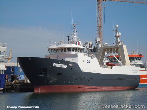
 Cap Saint Georges
Current Status
Where is the vessel?
Cap Saint Georges is currently in 22 nm NW of Athena FPSO, based on AIS data received about 1h ago.
Latest AIS update:
Current position: 58.90808° N, 1.47914° W (22 nm NW of Athena FPSO)
Average speed (last 7 days): Loading…
Average speed (last 30 days): Loading…
Vessel profile: Cap Saint Georges is a Fishing Vessel with dimensions 44m x 10m.
This page combines live AIS, route history, probable destination signals, nearby traffic, and port activity for practical vessel monitoring.
The current position of vessel Cap Saint Georges is 58.90808 lat / -1.47914 lng. Updated: 2026-04-19 23:40:34 UTCNearest reference points:
- Near Peterhead
- Near PETERHEAD
- Near Tingwall
Currently sailing under the flag of France ![]()
Details:
Live Vessel Cap Saint Georges Analytics (details, animations, etc.)
Recent AIS points (UTC):
2026-04-19 19:42:07 UTC · 59.69391, -1.52446 · SOG 10.3 kn · COG 152°2026-04-19 21:53:34 UTC · 59.27664, -1.41717 · SOG 12.5 kn · COG 181°
2026-04-19 22:40:44 UTC · 59.11537, -1.43891 · SOG 12.5 kn · COG 180°
2026-04-19 23:40:34 UTC · 58.90808, -1.47914 · SOG 12.9 kn · COG 180°