 vesseltracker.com
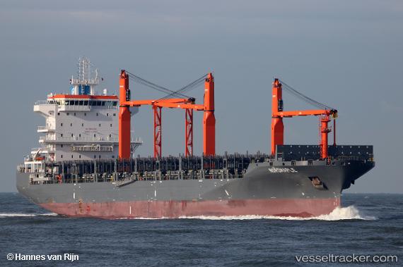
 MARIUS
Current Status
Where is the vessel?
MARIUS is currently in 42 nm W of Sociedad Portuaria Regional Cartagena, based on AIS data received about 1h ago.
Latest AIS update:
Current position: 10.23833° N, 76.21833° W (42 nm W of Sociedad Portuaria Regional Cartagena)
Average speed (last 7 days): Loading…
Average speed (last 30 days): Loading…
Vessel profile: MARIUS is a Cargo A with dimensions m x m.
This page combines live AIS, route history, probable destination signals, nearby traffic, and port activity for practical vessel monitoring.
The current position of vessel MARIUS is 10.23833 lat / -76.21833 lng. Updated: 2026-04-18 01:59:37 UTCNearest reference points:
- Near Sociedad Portuaria Regional Cartagena
- Near Contecar
- 62 nm NE of Playón Chico
Details:
Live Vessel MARIUS Analytics (details, animations, etc.)
Recent AIS points (UTC):
2026-04-17 18:32:37 UTC · 9.96833, -78.19500 · SOG 16 kn · COG -1°2026-04-17 20:44:39 UTC · 10.06500, -77.57333 · SOG 16 kn · COG -1°
2026-04-17 23:35:37 UTC · 10.16333, -76.77167 · SOG 16 kn · COG -1°
2026-04-18 01:59:37 UTC · 10.23833, -76.21833 · SOG 12 kn · COG -1°