 vesseltracker.com
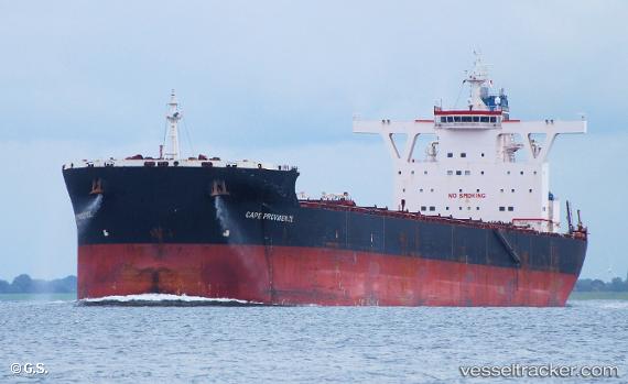
 MINERVA PROVIDENCE
Current Status
Where is the vessel?
MINERVA PROVIDENCE is currently in 42 nm NW of Bangui, based on AIS data received about 1d ago.
Latest AIS update:
Current position: 19.15532° N, 120.42128° E (42 nm NW of Bangui)
Average speed (last 7 days): Loading…
Average speed (last 30 days): Loading…
Vessel profile: MINERVA PROVIDENCE is a Bulk Carrier with dimensions 290m x 45m.
This page combines live AIS, route history, probable destination signals, nearby traffic, and port activity for practical vessel monitoring.
The current position of vessel MINERVA PROVIDENCE is 19.15532 lat / 120.42128 lng. Updated: 2026-04-10 07:40:37 UTCNearest reference points:
- 66 nm W of Basco
- 22 nm W of Salomague
- 106 nm W of Basco
Currently sailing under the flag of Malta ![]()
MINERVA PROVIDENCE built in 2010 year
Deadweight:
169234 tDetails:
Live Vessel MINERVA PROVIDENCE Analytics (details, animations, etc.)
Recent AIS points (UTC):
2026-04-10 01:40:16 UTC · 18.02195, 119.96313 · SOG 12.3 kn · COG 20°2026-04-10 03:56:55 UTC · 18.46463, 120.11561 · SOG 12 kn · COG 17°
2026-04-10 05:27:51 UTC · 18.75333, 120.21500 · SOG 12 kn · COG -1°
2026-04-10 07:40:37 UTC · 19.15532, 120.42128 · SOG 11.7 kn · COG 30°