 vesseltracker.com
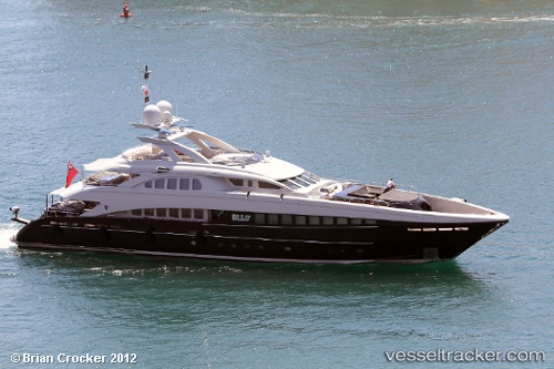
 Bliss
Bliss
Current Status
Where is the vessel?
Bliss is currently in Near PERAMA, based on AIS data received less than 1h ago.
Latest AIS update:
Current position: 37.96034° N, 23.57039° E (Near PERAMA)
Average speed (last 7 days): Loading…
Average speed (last 30 days): Loading…
Vessel profile: Bliss is a Service Ship with dimensions 44m x 10m.
This page combines live AIS, route history, probable destination signals, nearby traffic, and port activity for practical vessel monitoring.
The current position of vessel Bliss is 37.96034 lat / 23.57039 lng. Updated: 2026-04-17 03:46:12 UTCNearest reference points:
- Near PERAMA
- Near Keratsínion
- Near Drapetzona
Currently sailing under the flag of Malta ![]()
Bliss built in 2007 year
Deadweight:
228 tDetails:
Live Vessel Bliss Analytics (details, animations, etc.)
Recent AIS points (UTC):
2026-04-16 22:22:09 UTC · 37.96037, 23.57040 · SOG 0 kn · COG 185°2026-04-17 00:16:11 UTC · 37.96037, 23.57041 · SOG 0 kn · COG 184°
2026-04-17 02:40:17 UTC · 37.96037, 23.57039 · SOG 0 kn · COG 184°
2026-04-17 03:46:12 UTC · 37.96034, 23.57039 · SOG 0 kn · COG 184°