 vesseltracker.com
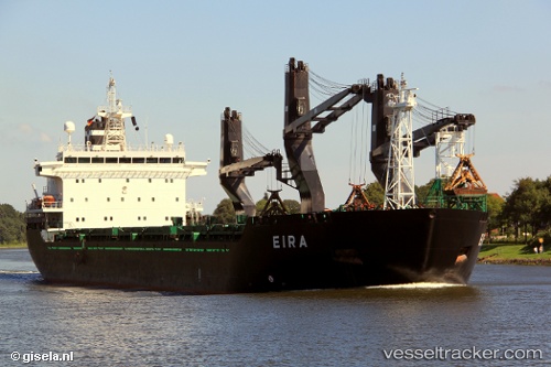
 Eira
Eira
Current Status
Where is the vessel?
Eira is currently in Near Yxpila, based on AIS data received about 6h ago.
Latest AIS update:
Current position: 63.86060° N, 23.03396° E (Near Yxpila)
Average speed (last 7 days): Loading…
Average speed (last 30 days): Loading…
Vessel profile: Eira is a General Cargo Ship with dimensions 157m x 25m.
This page combines live AIS, route history, probable destination signals, nearby traffic, and port activity for practical vessel monitoring.
The current position of vessel Eira is 63.86060 lat / 23.03396 lng. Updated: 2026-04-10 07:39:30 UTCNearest reference points:
- Near Karlsborg Axelvik
Currently sailing under the flag of Finland ![]()
Eira built in 2001 year
Deadweight:
19625 tDetails:
Live Vessel Eira Analytics (details, animations, etc.)
Recent AIS points (UTC):
2026-04-10 02:12:38 UTC · 63.73838, 21.70715 · SOG 11.7 kn · COG 60°2026-04-10 04:03:46 UTC · 63.91557, 22.41876 · SOG 11.5 kn · COG 61°
2026-04-10 05:36:07 UTC · 63.91305, 22.97421 · SOG 11.3 kn · COG 161°
2026-04-10 07:39:30 UTC · 63.86060, 23.03396 · SOG 0.1 kn · COG 293°