 vesseltracker.com
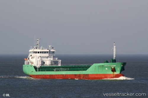
 HAV SUND
Current Status
Where is the vessel?
HAV SUND is currently in Near Haarlemmermeer, based on AIS data received less than 1h ago.
Latest AIS update:
Current position: 52.04285° N, 3.91209° E (Near Haarlemmermeer)
Average speed (last 7 days): Loading…
Average speed (last 30 days): Loading…
Vessel profile: HAV SUND is a General Cargo Ship with dimensions 90m x 15m.
This page combines live AIS, route history, probable destination signals, nearby traffic, and port activity for practical vessel monitoring.
The current position of vessel HAV SUND is 52.04285 lat / 3.91209 lng. Updated: 2026-04-20 21:25:02 UTCNearest reference points:
- Near Haarlemmermeer
- Near MAASVLAKTE - ROTTERDAM
- Near HOEK VAN HOLLAND
Currently sailing under the flag of Faroe Islands ![]()
HAV SUND built in 2008 year
Deadweight:
4950 tDetails:
Live Vessel HAV SUND Analytics (details, animations, etc.)
Recent AIS points (UTC):
2026-04-20 17:54:38 UTC · 51.90710, 4.41522 · SOG 0 kn · COG 333°2026-04-20 19:57:52 UTC · 51.89537, 4.31614 · SOG 12.6 kn · COG 277°
2026-04-20 20:03:02 UTC · 51.89919, 4.28696 · SOG 13.2 kn · COG 292°
2026-04-20 21:25:02 UTC · 52.04285, 3.91209 · SOG 6.8 kn · COG 8°