 vesseltracker.com
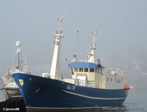
Tugvusteinur
Current StatusWhere is the vessel?
Tugvusteinur is currently in 40 nm NE of Klaksvig, based on AIS data received about 1h ago.
Latest AIS update:
Current position: 62.75827° N, 5.68874° W (40 nm NE of Klaksvig)
Average speed (last 7 days): Loading…
Average speed (last 30 days): Loading…
Vessel profile: Tugvusteinur is a Fishing Vessel with dimensions 6m x 33m.
This page combines live AIS, route history, probable destination signals, nearby traffic, and port activity for practical vessel monitoring.
The current position of vessel Tugvusteinur is 62.75827 lat / -5.68874 lng. Updated: 2026-04-13 06:07:58 UTCNearest reference points:
- Near FUGLAFJORDUR
- Near VESTMANNA
- 20 nm S of Vágur
Details:
Live Vessel Tugvusteinur Analytics (details, animations, etc.)
Recent AIS points (UTC):
2026-04-12 23:20:34 UTC · 62.74780, -5.76410 · SOG 4.6 kn · COG -1°2026-04-13 02:26:01 UTC · 62.75426, -5.76157 · SOG 3.9 kn · COG -1°
2026-04-13 04:20:01 UTC · 62.75984, -5.71974 · SOG 1.2 kn · COG -1°
2026-04-13 06:07:58 UTC · 62.75827, -5.68874 · SOG 0.9 kn · COG -1°