 vesseltracker.com
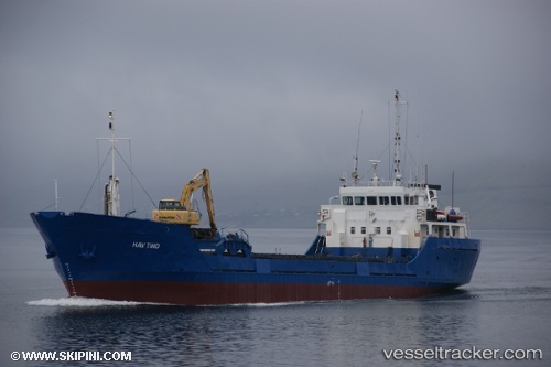
 Hav Tind
Current Status
Where is the vessel?
Hav Tind is currently in Near Trangisvaag, based on AIS data received about 1h ago.
Latest AIS update:
Current position: 61.54293° N, 6.76386° W (Near Trangisvaag)
Average speed (last 7 days): Loading…
Average speed (last 30 days): Loading…
Vessel profile: Hav Tind is a General Cargo Ship with dimensions 60m x 11m.
This page combines live AIS, route history, probable destination signals, nearby traffic, and port activity for practical vessel monitoring.
The current position of vessel Hav Tind is 61.54293 lat / -6.76386 lng. Updated: 2026-04-08 10:06:54 UTCNearest reference points:
- 20 nm S of Vágur
- Near FUGLAFJORDUR
- Near VESTMANNA
Currently sailing under the flag of Faroe Is ![]()
Hav Tind built in 1980 year
Deadweight:
1315 tDetails:
Live Vessel Hav Tind Analytics (details, animations, etc.)
Recent AIS points (UTC):
2026-04-08 03:59:55 UTC · 61.47189, -6.80660 · SOG 0 kn · COG 278°2026-04-08 06:25:57 UTC · 61.46414, -6.78372 · SOG 0.1 kn · COG 113°
2026-04-08 08:17:54 UTC · 61.49635, -6.73232 · SOG 0.1 kn · COG 247°
2026-04-08 10:06:54 UTC · 61.54293, -6.76386 · SOG 0.6 kn · COG 112°