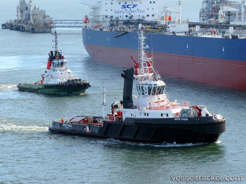
 Hopetoun
Current Status
Where is the vessel?
Hopetoun is currently in Near SOUTH QUEENSFERRY, based on AIS data received about 14h ago.
Latest AIS update:
Current position: 56.00127° N, 3.37240° W (Near SOUTH QUEENSFERRY)
Average speed (last 7 days): Loading…
Average speed (last 30 days): Loading…
Vessel profile: Hopetoun is a Tug with dimensions 43m x 14m.
This page combines live AIS, route history, probable destination signals, nearby traffic, and port activity for practical vessel monitoring.
The current position of vessel Hopetoun is 56.00127 lat / -3.37240 lng. Updated: 2026-05-23 11:13:28 UTCNearest reference points:
- Near Leith
- Near BROUGHTY FERRY
- Near North Berwick
Currently sailing under the flag of United Kingdom ![]()
Hopetoun built in 1997 year
Deadweight:
637 tDetails:
Live Vessel Hopetoun Analytics (details, animations, etc.)
Recent AIS points (UTC):
2026-05-23 07:52:36 UTC · 56.00133, -3.37262 · SOG 0 kn · COG 50°2026-05-23 07:58:43 UTC · 56.00126, -3.37256 · SOG 0 kn · COG 62°
2026-05-23 09:46:51 UTC · 56.00137, -3.37247 · SOG 0 kn · COG 42°
2026-05-23 11:13:28 UTC · 56.00127, -3.37240 · SOG 0 kn · COG 56°