 vesseltracker.com
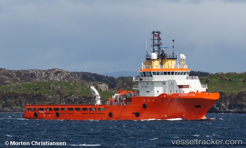
 OCEANICASUB XVII
Current Status
Where is the vessel?
OCEANICASUB XVII is currently in Near NITEROI, based on AIS data received less than 1h ago.
Latest AIS update:
Current position: 22.88149° S, 43.11662° W (Near NITEROI)
Average speed (last 7 days): Loading…
Average speed (last 30 days): Loading…
Vessel profile: OCEANICASUB XVII is a Anchor Handling Vessel with dimensions m x m.
This page combines live AIS, route history, probable destination signals, nearby traffic, and port activity for practical vessel monitoring.
The current position of vessel OCEANICASUB XVII is -22.88149 lat / -43.11662 lng. Updated: 2026-04-17 09:32:56 UTCNearest reference points:
- Near NITEROI
- Near Rio De Janeiro
- Near Santos Dumont Apt/Rio de Janeiro
Currently sailing under the flag of United Kingdom ![]()
Details:
Live Vessel OCEANICASUB XVII Analytics (details, animations, etc.)
Recent AIS points (UTC):
2026-04-17 03:20:48 UTC · -22.88151, -43.11660 · SOG 0 kn · COG 340°2026-04-17 06:05:49 UTC · -22.88149, -43.11665 · SOG 0 kn · COG 340°
2026-04-17 08:02:50 UTC · -22.88147, -43.11662 · SOG 0 kn · COG 340°
2026-04-17 09:32:56 UTC · -22.88149, -43.11662 · SOG 0 kn · COG 340°