 vesseltracker.com
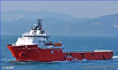
 PACIFIC LIBERTY
Current Status
Where is the vessel?
PACIFIC LIBERTY is currently in 32 nm NW of Rio Tuba, based on AIS data received less than 1h ago.
Latest AIS update:
Current position: 8.76333° N, 116.95333° E (32 nm NW of Rio Tuba)
Average speed (last 7 days): Loading…
Average speed (last 30 days): Loading…
Vessel profile: PACIFIC LIBERTY is a Other Type with dimensions m x m.
This page combines live AIS, route history, probable destination signals, nearby traffic, and port activity for practical vessel monitoring.
The current position of vessel PACIFIC LIBERTY is 8.76333 lat / 116.95333 lng. Updated: 2026-04-16 21:23:57 UTCNearest reference points:
- 35 nm SE of Brookes Point, Palawan
- 70 nm W of Puerto Princesa
- 159 nm N of Pulau Lang Lang
Currently sailing under the flag of United Kingdom ![]()
Details:
Live Vessel PACIFIC LIBERTY Analytics (details, animations, etc.)
Recent AIS points (UTC):
2026-04-16 15:57:14 UTC · 9.56143, 117.57237 · SOG 11 kn · COG 229°2026-04-16 17:11:55 UTC · 9.38500, 117.42500 · SOG 11 kn · COG -1°
2026-04-16 19:41:54 UTC · 9.01500, 117.14500 · SOG 11 kn · COG -1°
2026-04-16 21:23:57 UTC · 8.76333, 116.95333 · SOG 11 kn · COG -1°