 vesseltracker.com
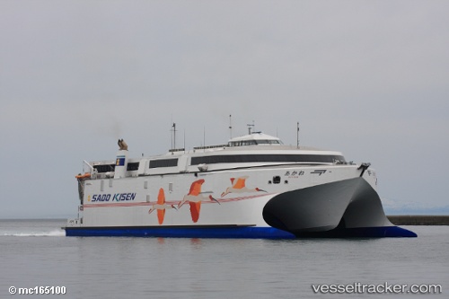
 LEVANTE JET
Current Status
Where is the vessel?
LEVANTE JET is currently in Near SAINT MALO, based on AIS data received less than 1h ago.
Latest AIS update:
Current position: 48.64106° N, 2.02834° W (Near SAINT MALO)
Average speed (last 7 days): Loading…
Average speed (last 30 days): Loading…
Vessel profile: LEVANTE JET is a High speed craft with dimensions m x m.
This page combines live AIS, route history, probable destination signals, nearby traffic, and port activity for practical vessel monitoring.
The current position of vessel LEVANTE JET is 48.64106 lat / -2.02834 lng. Updated: 2026-04-17 23:24:19 UTCNearest reference points:
- Near SAINT MALO
- Near Saint-Malo
- Near SAINT CAST LE GUIDO
Currently sailing under the flag of United Kingdom ![]()
Details:
Live Vessel LEVANTE JET Analytics (details, animations, etc.)
Recent AIS points (UTC):
2026-04-17 17:35:26 UTC · 49.16081, -2.12380 · SOG 13.8 kn · COG 339°2026-04-17 19:55:19 UTC · 48.82999, -1.97425 · SOG 25.2 kn · COG 188°
2026-04-17 22:15:18 UTC · 48.64109, -2.02833 · SOG 0 kn · COG 259°
2026-04-17 23:24:19 UTC · 48.64106, -2.02834 · SOG 0 kn · COG 258°