 vesseltracker.com
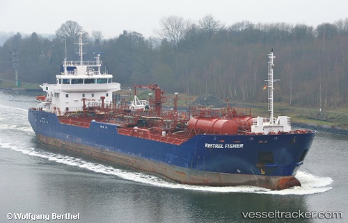
 KESTREL FISHER
Current Status
Where is the vessel?
KESTREL FISHER is currently in Near CUL DESAC, based on AIS data received about 15h ago.
Latest AIS update:
Current position: 13.98249° N, 61.01452° W (Near CUL DESAC)
Average speed (last 7 days): Loading…
Average speed (last 30 days): Loading…
Vessel profile: KESTREL FISHER is a Oil Products Tanker with dimensions m x m.
This page combines live AIS, route history, probable destination signals, nearby traffic, and port activity for practical vessel monitoring.
The current position of vessel KESTREL FISHER is 13.98249 lat / -61.01452 lng. Updated: 2026-04-17 04:07:29 UTCNearest reference points:
- Near Gros Islet
- Near LE MARIN
- Near Fort De France
Currently sailing under the flag of United Kingdom ![]()
Details:
Live Vessel KESTREL FISHER Analytics (details, animations, etc.)
Recent AIS points (UTC):
2026-04-17 03:26:18 UTC · 14.02423, -61.02138 · SOG 9.9 kn · COG 227°2026-04-17 04:07:29 UTC · 13.98249, -61.01452 · SOG 0.2 kn · COG 26°
2026-04-17 04:07:29 UTC · 13.98249, -61.01452 · SOG 0.2 kn · COG 26°
2026-04-17 04:07:29 UTC · 13.98249, -61.01452 · SOG 0.2 kn · COG 26°