 vesseltracker.com
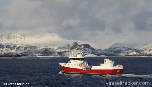
 OCEAN PROSPER
Current Status
Where is the vessel?
OCEAN PROSPER is currently in 13 nm N of Kinlochbervie, based on AIS data received about 1h ago.
Latest AIS update:
Current position: 58.66635° N, 4.91658° W (13 nm N of Kinlochbervie)
Average speed (last 7 days): Loading…
Average speed (last 30 days): Loading…
Vessel profile: OCEAN PROSPER is a Fish Carrier with dimensions m x m.
This page combines live AIS, route history, probable destination signals, nearby traffic, and port activity for practical vessel monitoring.
The current position of vessel OCEAN PROSPER is 58.66635 lat / -4.91658 lng. Updated: 2026-04-09 11:42:41 UTCNearest reference points:
- Near Culkein
- Near Fortrose
- Near Inverness
Currently sailing under the flag of United Kingdom ![]()
Details:
Live Vessel OCEAN PROSPER Analytics (details, animations, etc.)
Recent AIS points (UTC):
2026-04-09 05:37:50 UTC · 57.67892, -5.87585 · SOG 10.9 kn · COG 1°2026-04-09 07:27:59 UTC · 58.00240, -5.71649 · SOG 10.7 kn · COG 38°
2026-04-09 09:55:21 UTC · 58.40447, -5.31619 · SOG 11.2 kn · COG 28°
2026-04-09 11:42:41 UTC · 58.66635, -4.91658 · SOG 12 kn · COG 64°