 vesseltracker.com
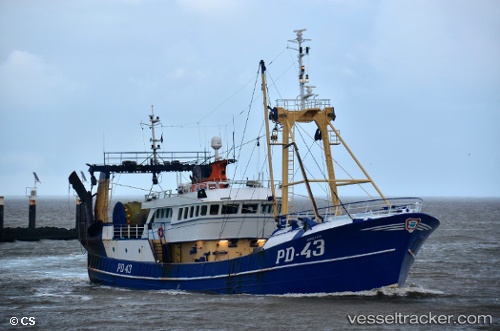
 Annegina
Current Status
Where is the vessel?
Annegina is currently in 23 nm NW of de Ruyter, based on AIS data received less than 1h ago.
Latest AIS update:
Current position: 52.50968° N, 3.52521° E (23 nm NW of de Ruyter)
Average speed (last 7 days): Loading…
Average speed (last 30 days): Loading…
Vessel profile: Annegina is a Fishing Vessel with dimensions 42m x 9m.
This page combines live AIS, route history, probable destination signals, nearby traffic, and port activity for practical vessel monitoring.
The current position of vessel Annegina is 52.50968 lat / 3.52521 lng. Updated: 2026-04-09 19:58:27 UTCNearest reference points:
- 23 nm N of de Ruyter
- Near de Ruyter
- 22 nm W of Schoorl
Currently sailing under the flag of United Kingdom ![]()
Annegina built in 1984 year
Details:
Live Vessel Annegina Analytics (details, animations, etc.)
Recent AIS points (UTC):
2026-04-09 13:23:03 UTC · 52.43822, 3.18115 · SOG 4 kn · COG 164°2026-04-09 16:02:47 UTC · 52.34507, 3.17812 · SOG 3.5 kn · COG -1°
2026-04-09 17:24:26 UTC · 52.42814, 3.18364 · SOG 4 kn · COG -1°
2026-04-09 19:58:27 UTC · 52.50968, 3.52521 · SOG 10.8 kn · COG -1°