 vesseltracker.com
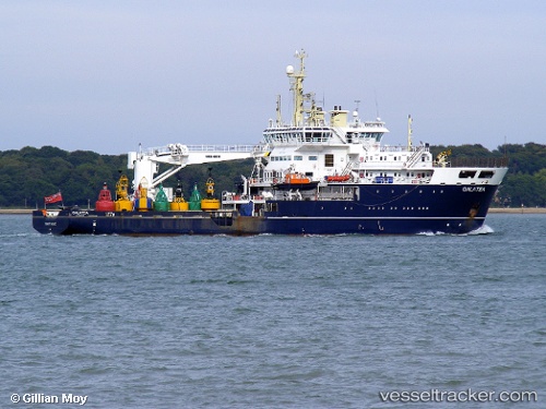
 Galatea
Current Status
Where is the vessel?
Galatea is currently in 16 nm E of Somersby, based on AIS data received less than 1h ago.
Latest AIS update:
Current position: 53.21208° N, 1.44984° E (16 nm E of Somersby)
Average speed (last 7 days): Loading…
Average speed (last 30 days): Loading…
Vessel profile: Galatea is a Buoy Lighthouse Vessel with dimensions 84m x 16m.
This page combines live AIS, route history, probable destination signals, nearby traffic, and port activity for practical vessel monitoring.
The current position of vessel Galatea is 53.21208 lat / 1.44984 lng. Updated: 2026-04-14 21:33:40 UTCNearest reference points:
- Near Hedenham
- Near Hoveton
- Near Hemsby
Currently sailing under the flag of United Kingdom ![]()
Galatea built in 2007 year
Deadweight:
1200 tDetails:
Live Vessel Galatea Analytics (details, animations, etc.)
Recent AIS points (UTC):
2026-04-14 15:50:01 UTC · 53.20811, 1.42735 · SOG 0 kn · COG 193°2026-04-14 17:40:19 UTC · 53.21167, 1.45167 · SOG 0 kn · COG -1°
2026-04-14 20:15:40 UTC · 53.21212, 1.44989 · SOG 0 kn · COG 159°
2026-04-14 21:33:40 UTC · 53.21208, 1.44984 · SOG 0 kn · COG 160°