 vesseltracker.com
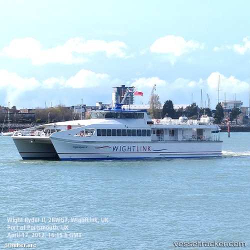
 Wight Ryder 2
Current Status
Where is the vessel?
Wight Ryder 2 is currently in Near GOSPORT, based on AIS data received about 1d ago.
Latest AIS update:
Current position: 50.79637° N, 1.10940° W (Near GOSPORT)
Average speed (last 7 days): Loading…
Average speed (last 30 days): Loading…
Vessel profile: Wight Ryder 2 is a Passenger Ship with dimensions 41m x 12m.
This page combines live AIS, route history, probable destination signals, nearby traffic, and port activity for practical vessel monitoring.
The current position of vessel Wight Ryder 2 is 50.79637 lat / -1.10940 lng. Updated: 2026-04-10 08:07:57 UTCNearest reference points:
- Near GOSPORT
- Near Portsmouth
- Near SOLENT
Currently sailing under the flag of United Kingdom ![]()
Wight Ryder 2 built in 2009 year
Deadweight:
130 tDetails:
Live Vessel Wight Ryder 2 Analytics (details, animations, etc.)
Recent AIS points (UTC):
2026-04-10 02:37:13 UTC · 50.79661, -1.10929 · SOG 0 kn · COG 352°2026-04-10 04:21:08 UTC · 50.77873, -1.10556 · SOG 17.9 kn · COG 203°
2026-04-10 05:21:37 UTC · 50.78507, -1.10888 · SOG 11.2 kn · COG 167°
2026-04-10 08:07:57 UTC · 50.79637, -1.10940 · SOG 3 kn · COG 7°