 vesseltracker.com
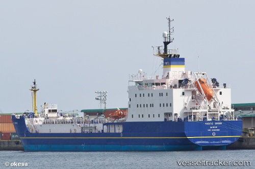
 Pacific Grebe
Current Status
Where is the vessel?
Pacific Grebe is currently in Near Cawsand, based on AIS data received about 1d ago.
Latest AIS update:
Current position: 50.29816° N, 4.29670° W (Near Cawsand)
Average speed (last 7 days): Loading…
Average speed (last 30 days): Loading…
Vessel profile: Pacific Grebe is a Nuclear Fuel Carrier with dimensions 104m x 18m.
This page combines live AIS, route history, probable destination signals, nearby traffic, and port activity for practical vessel monitoring.
The current position of vessel Pacific Grebe is 50.29816 lat / -4.29670 lng. Updated: 2026-04-10 08:07:55 UTCNearest reference points:
- Near Portwrinkle
- Near Devonport
- Near TORPOINT
Currently sailing under the flag of United Kingdom ![]()
Pacific Grebe built in 2010 year
Deadweight:
4902 tDetails:
Live Vessel Pacific Grebe Analytics (details, animations, etc.)
Recent AIS points (UTC):
2026-04-10 02:37:12 UTC · 49.89253, -5.00412 · SOG 13.6 kn · COG 220°2026-04-10 04:21:06 UTC · 50.11119, -4.70604 · SOG 13.1 kn · COG 44°
2026-04-10 05:21:36 UTC · 50.20078, -4.60532 · SOG 13.5 kn · COG 224°
2026-04-10 08:07:55 UTC · 50.29816, -4.29670 · SOG 9.5 kn · COG 270°