 vesseltracker.com
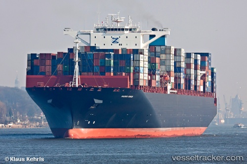
 Edison
Current Status
Where is the vessel?
Edison is currently in 75 nm SE of Minachi, based on AIS data received less than 1h ago.
Latest AIS update:
Current position: 32.70512° N, 136.44905° E (75 nm SE of Minachi)
Average speed (last 7 days): Loading…
Average speed (last 30 days): Loading…
Vessel profile: Edison is a Container Ship with dimensions 366m x 48m.
This page combines live AIS, route history, probable destination signals, nearby traffic, and port activity for practical vessel monitoring.
The current position of vessel Edison is 32.70512 lat / 136.44905 lng. Updated: 2026-04-21 22:38:49 UTCNearest reference points:
- 88 nm SE of Minachi
- 23 nm S of Minachi
- 40 nm SW of Minachi
Currently sailing under the flag of United Kingdom ![]()
Edison built in 2011 year
Deadweight:
141448 tDetails:
Live Vessel Edison Analytics (details, animations, etc.)
Recent AIS points (UTC):
2026-04-21 19:38:15 UTC · 32.39167, 135.39764 · SOG 18.7 kn · COG -1°2026-04-21 20:13:18 UTC · 32.45393, 135.60446 · SOG 19.1 kn · COG 74°
2026-04-21 21:50:56 UTC · 32.62470, 136.17732 · SOG 18.2 kn · COG 70°
2026-04-21 22:38:49 UTC · 32.70512, 136.44905 · SOG 18.3 kn · COG 68°