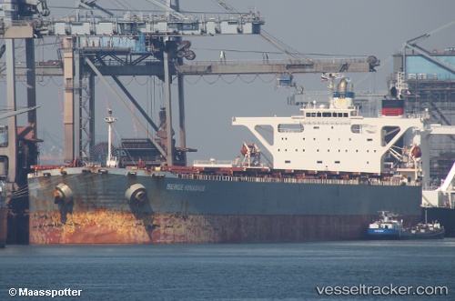
.
Vessel photo of Berge Kinabalu (IMO 9271391) vesseltracker.com

Berge Kinabalu

Vessel type: Ore Carrier | IMO: 9271391 | MMSI: MMSI: 235101105
Call sign: 2GWN3 | Dimensions: 45 m x 289 m
Current Status

Where is the vessel?

Berge Kinabalu is currently in 11 nm SE of YANGSHAN, based on AIS data received about 1h ago.

Latest AIS update:

Current position: 30.47723° N, 122.27773° E (11 nm SE of YANGSHAN)

Average speed (last 7 days): Loading…

Average speed (last 30 days): Loading…

Vessel profile: Berge Kinabalu is a Ore Carrier with dimensions 45m x 289m.

This page combines live AIS, route history, probable destination signals, nearby traffic, and port activity for practical vessel monitoring.

The current position of vessel Berge Kinabalu is 30.47723 lat / 122.27773 lng. Updated: 2026-04-10 05:44:13 UTC
Nearest reference points:
  • 11 nm N of JINHAI HEAVY INDUSTR
  • 10 nm NE of JINHAI HEAVY INDUSTR
  • 14 nm NE of JINHAI HEAVY INDUSTR
Details:

Live Vessel Berge Kinabalu Analytics (details, animations, etc.)


Recent AIS points (UTC):
2026-04-09 23:21:55 UTC · 30.47720, 122.27772 · SOG 0 kn · COG 249°
2026-04-10 01:51:55 UTC · 30.47722, 122.27771 · SOG 0 kn · COG 249°
2026-04-10 02:45:55 UTC · 30.47719, 122.27768 · SOG 0 kn · COG 249°
2026-04-10 05:44:13 UTC · 30.47723, 122.27773 · SOG 0 kn · COG 249°

Track of the vessel in the last 60 days


UTC: --
Start: -- Track timeline (UTC) End: --
Encountered: --


Link to the map:


Find another ship

Berge_Kinabalu (235101105) last ports (portcalls and passsages)

Fangcheng | 2025-09-01 10:26:02
PENGERANG | 2025-08-22 13:57:51
TANAH MERAH | 2025-08-21 19:56:30
PULAU SAMBU | 2025-08-21 18:26:06
PULAU SAMBU | 2025-05-11 22:13:49
TANAH MERAH | 2025-05-10 19:49:08
PENGERANG | 2025-05-10 18:26:28
Longkou | 2025-04-15 11:00:31
Richards Bay | 2024-12-13 14:24:42
DAHEJ | 2024-11-25 15:09:27
PULAU SAMBU | 2024-11-09 07:54:04
PENGERANG | 2024-11-09 04:44:41
Taicang | 2024-10-15 04:33:47
Wusong | 2024-10-15 02:31:21
Jingjiang | 2024-10-14 21:28:23
Singapore | 2024-07-12 08:09:26
Zhangjiagang | 2024-06-29 04:24:00
Nantong | 2024-06-29 01:24:54
Taicang | 2024-06-28 22:44:49
Wusong | 2024-06-28 21:09:31
Jingjiang | 2024-06-28 15:31:42
Sambu | 2024-03-15 00:10:43
Sambu | 2024-02-06 09:27:09
Strait Of Gibraltar | 2023-12-16 05:31:46
Port Said | 2023-12-09 15:09:22
Bur Ibrahim | 2023-12-09 05:51:08
Singapore | 2023-11-05 23:48:54
Taboneo | 2023-10-29 19:52:15
Taboneo | 2023-10-25 20:22:22
Taboneo | 2023-10-21 19:59:01
Taboneo | 2023-10-17 19:33:06
Taboneo | 2023-10-13 18:26:37
Panjang | 2023-08-31 15:27:02
Singapore | 2023-06-14 19:29:20
Taicang | 2023-05-13 14:07:50
Wusong | 2023-05-13 11:37:12
Panjang | 2023-04-28 23:51:51
Singapore | 2022-11-08 23:24:28
Bur Ibrahim | 2022-10-21 16:05:35
Algeciras | 2022-10-13 13:33:53
Strait Of Gibraltar | 2022-10-12 04:12:42
Sept Iles | 2022-09-28 16:53:31
Strait Of Gibraltar | 2022-09-14 13:04:24
Algeciras | 2022-09-09 22:51:37
Alexandria | 2022-08-29 16:12:50
Narvik | 2022-08-10 08:06:27
Narvik | 2022-08-06 07:35:33
Narvik | 2022-08-02 05:11:47
Cuxhaven | 2022-07-28 17:02:02
Dunkerque | 2022-07-22 19:42:44
Dunkerque | 2022-07-18 16:45:45
Calais | 2022-07-18 14:16:06
Sao Luiz | 2022-07-01 05:16:08
Strait Of Gibraltar | 2022-06-14 16:03:07
Yumurtalik | 2022-06-07 14:01:02
Botas | 2022-06-07 04:33:24
Botas | 2022-06-03 04:15:55
Algeciras | 2022-05-26 07:03:35
Stadersand | 2022-04-14 00:35:49
Cuxhaven | 2022-04-13 21:05:38
Narvik | 2022-03-15 09:05:20
Cuxhaven | 2022-03-11 12:25:39
Stadersand | 2022-03-11 09:25:12
Narvik | 2022-02-22 09:40:48
Dunkerque | 2022-02-07 20:43:50
Calais | 2022-02-06 15:20:05
Aviles | 2022-01-24 23:05:57
Sao Luiz | 2022-01-09 21:54:59