 vesseltracker.com
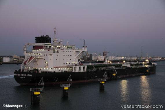
British Resolution
Current StatusWhere is the vessel?
British Resolution is currently in 52 nm NW of Camden Park, based on AIS data received about 1h ago.
Latest AIS update:
Current position: 13.70063° N, 61.93187° W (52 nm NW of Camden Park)
Average speed (last 7 days): Loading…
Average speed (last 30 days): Loading…
Vessel profile: British Resolution is a Crude Oil Tanker with dimensions 44m x 250m.
This page combines live AIS, route history, probable destination signals, nearby traffic, and port activity for practical vessel monitoring.
The current position of vessel British Resolution is 13.70063 lat / -61.93187 lng. Updated: 2026-04-03 16:03:13 UTCNearest reference points:
- Near Kingstown
- Near Gros Islet
- Near Fort De France
Details:
Live Vessel British Resolution Analytics (details, animations, etc.)
Recent AIS points (UTC):
2026-04-03 09:24:11 UTC · 13.89357, -63.30089 · SOG 12 kn · COG 97°2026-04-03 12:21:54 UTC · 13.80390, -62.68959 · SOG 12.2 kn · COG 98°
2026-04-03 14:23:51 UTC · 13.74666, -62.26765 · SOG 11.5 kn · COG 104°
2026-04-03 16:03:13 UTC · 13.70063, -61.93187 · SOG 12.6 kn · COG 103°