 vesseltracker.com
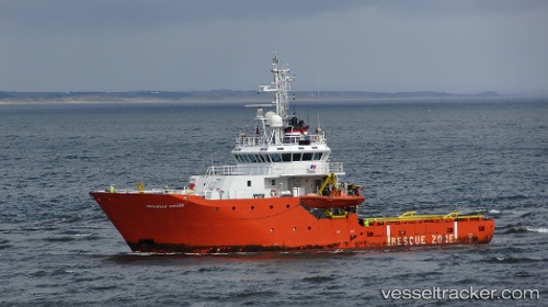
 Grampian Ranger
Current Status
Where is the vessel?
Grampian Ranger is currently in Near Echt, based on AIS data received about 9h ago.
Latest AIS update:
Current position: 57.17883° N, 2.28067° E (Near Echt)
Average speed (last 7 days): Loading…
Average speed (last 30 days): Loading…
Vessel profile: Grampian Ranger is a Standby Safety Vessel with dimensions 47m x 11m.
This page combines live AIS, route history, probable destination signals, nearby traffic, and port activity for practical vessel monitoring.
The current position of vessel Grampian Ranger is 57.17883 lat / 2.28067 lng. Updated: 2026-04-18 11:08:27 UTCNearest reference points:
- Near Alba Oil Field
- 19 nm W of Curlew
- 26 nm W of Cleghorn
Currently sailing under the flag of United Kingdom ![]()
Grampian Ranger built in 2002 year
Deadweight:
300 tDetails:
Live Vessel Grampian Ranger Analytics (details, animations, etc.)
Recent AIS points (UTC):
2026-04-18 04:21:23 UTC · 57.12483, 2.32267 · SOG 0.5 kn · COG 183°2026-04-18 11:08:27 UTC · 57.17883, 2.28067 · SOG 1.4 kn · COG 348°
2026-04-18 11:08:27 UTC · 57.17883, 2.28067 · SOG 1.4 kn · COG 348°
2026-04-18 11:08:27 UTC · 57.17883, 2.28067 · SOG 1.4 kn · COG 348°