 vesseltracker.com
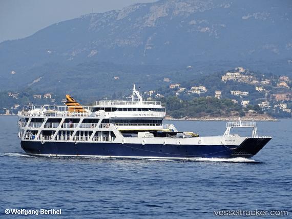
Nanti
Current StatusWhere is the vessel?
Nanti is currently in Near KERKYRA, based on AIS data received about 4h ago.
Latest AIS update:
Current position: 39.62781° N, 19.90330° E (Near KERKYRA)
Average speed (last 7 days): Loading…
Average speed (last 30 days): Loading…
Vessel profile: Nanti is a Passenger Ro Ro Cargo Ship with dimensions 16m x 78m.
This page combines live AIS, route history, probable destination signals, nearby traffic, and port activity for practical vessel monitoring.
The current position of vessel Nanti is 39.62781 lat / 19.90330 lng. Updated: 2026-04-10 07:24:00 UTCNearest reference points:
- Near KERKYRA
- Near Corfu
- Near GOUVIA KONTOKALI
Details:
Live Vessel Nanti Analytics (details, animations, etc.)
Recent AIS points (UTC):
2026-04-09 22:10:40 UTC · 39.49892, 20.26297 · SOG 0 kn · COG -1°2026-04-09 22:10:40 UTC · 39.49892, 20.26297 · SOG 0 kn · COG -1°
2026-04-10 05:32:50 UTC · 39.51807, 20.14212 · SOG 11.4 kn · COG -1°
2026-04-10 07:24:00 UTC · 39.62781, 19.90330 · SOG 0 kn · COG -1°