 vesseltracker.com
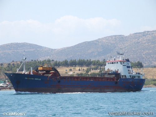
 Kalliopi Koymianoy
Current Status
Where is the vessel?
Kalliopi Koymianoy is currently in Near LEROS, based on AIS data received less than 1h ago.
Latest AIS update:
Current position: 37.12631° N, 26.88288° E (Near LEROS)
Average speed (last 7 days): Loading…
Average speed (last 30 days): Loading…
Vessel profile: Kalliopi Koymianoy is a General Cargo Ship with dimensions 53m x 10m.
This page combines live AIS, route history, probable destination signals, nearby traffic, and port activity for practical vessel monitoring.
The current position of vessel Kalliopi Koymianoy is 37.12631 lat / 26.88288 lng. Updated: 2026-04-16 05:55:00 UTCNearest reference points:
- Near KALYMNOS
- Near PATMOS
- Near TURGUTREIS
Currently sailing under the flag of Greece ![]()
Kalliopi Koymianoy built in 1971 year
Deadweight:
589 tDetails:
Live Vessel Kalliopi Koymianoy Analytics (details, animations, etc.)
Recent AIS points (UTC):
2026-04-15 23:30:00 UTC · 37.12639, 26.88281 · SOG 0.1 kn · COG 0°2026-04-16 01:31:41 UTC · 37.12639, 26.88284 · SOG 0.1 kn · COG 0°
2026-04-16 03:58:19 UTC · 37.12640, 26.88283 · SOG 0.1 kn · COG 2°
2026-04-16 05:55:00 UTC · 37.12631, 26.88288 · SOG 0.1 kn · COG 357°