 vesseltracker.com
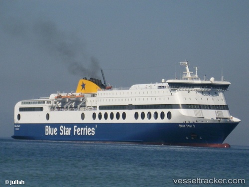
 Blue Star 2
Current Status
Where is the vessel?
Blue Star 2 is currently in Near Piraeus, based on AIS data received about 87d ago.
Latest AIS update:
Current position: 37.94103° N, 23.62515° E (Near Piraeus)
Average speed (last 7 days): Loading…
Average speed (last 30 days): Loading…
Vessel profile: Blue Star 2 is a Passenger Ro Ro Cargo Ship with dimensions 176m x 26m.
This page combines live AIS, route history, probable destination signals, nearby traffic, and port activity for practical vessel monitoring.
The current position of vessel Blue Star 2 is 37.94103 lat / 23.62515 lng. Updated: 2026-01-21 10:00:02 UTCNearest reference points:
- Near Piraeus
- Near ZEA
- Near Drapetzona
Currently sailing under the flag of Greece ![]()
Blue Star 2 built in 2000 year
Deadweight:
5075 tDetails:
Live Vessel Blue Star 2 Analytics (details, animations, etc.)
Recent AIS points (UTC):
2026-01-21 10:00:02 UTC · 37.94103, 23.62515 · SOG 0 kn · COG 150°