 vesseltracker.com
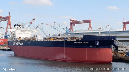
 Cap Corpus Christi
Current Status
Where is the vessel?
Cap Corpus Christi is currently in 231 nm NE of Ben Slimane, based on AIS data received about 1h ago.
Latest AIS update:
Current position: 36.28667° N, 67.83167° W (231 nm NE of Ben Slimane)
Average speed (last 7 days): Loading…
Average speed (last 30 days): Loading…
Vessel profile: Cap Corpus Christi is a Crude Oil Tanker with dimensions 277m x 48m.
This page combines live AIS, route history, probable destination signals, nearby traffic, and port activity for practical vessel monitoring.
The current position of vessel Cap Corpus Christi is 36.28667 lat / -67.83167 lng. Updated: 2026-04-21 20:03:42 UTCNearest reference points:
- 169 nm NE of Ben Slimane
- 273 nm SE of NANTUCKET
- 187 nm SE of Offshore Ambrose
Currently sailing under the flag of Greece ![]()
Details:
Live Vessel Cap Corpus Christi Analytics (details, animations, etc.)
Recent AIS points (UTC):
2026-04-21 16:09:42 UTC · 36.75667, -67.29333 · SOG 9 kn · COG -1°2026-04-21 18:09:41 UTC · 36.51667, -67.57333 · SOG 9 kn · COG -1°
2026-04-21 19:15:41 UTC · 36.38500, -67.72500 · SOG 9 kn · COG -1°
2026-04-21 20:03:42 UTC · 36.28667, -67.83167 · SOG 9 kn · COG -1°