 vesseltracker.com
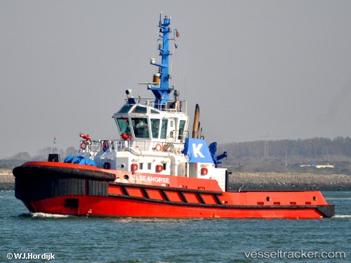
 THISEAS
Current Status
Where is the vessel?
THISEAS is currently in Near Souda Bay, based on AIS data received less than 1h ago.
Latest AIS update:
Current position: 35.49655° N, 24.13746° E (Near Souda Bay)
Average speed (last 7 days): Loading…
Average speed (last 30 days): Loading…
Vessel profile: THISEAS is a Tug with dimensions m x m.
This page combines live AIS, route history, probable destination signals, nearby traffic, and port activity for practical vessel monitoring.
The current position of vessel THISEAS is 35.49655 lat / 24.13746 lng. Updated: 2026-04-21 05:58:45 UTCNearest reference points:
- Near Kali Limenes
- Near Iraklion
- 17 nm W of Milos (Adamas)
Currently sailing under the flag of Greece ![]()
Details:
Live Vessel THISEAS Analytics (details, animations, etc.)
Recent AIS points (UTC):
2026-04-20 20:18:25 UTC · 35.49241, 24.06886 · SOG 0 kn · COG -1°2026-04-21 04:02:49 UTC · 35.49241, 24.06885 · SOG 0 kn · COG 287°
2026-04-21 04:39:54 UTC · 35.49419, 24.07120 · SOG 5.1 kn · COG 48°
2026-04-21 05:58:45 UTC · 35.49655, 24.13746 · SOG 0 kn · COG 76°