 vesseltracker.com
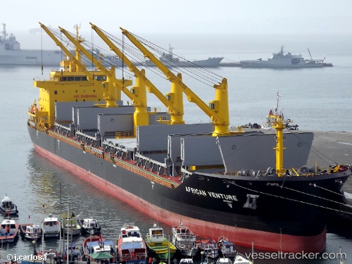
 IRAKLIS
Current Status
Where is the vessel?
IRAKLIS is currently in Near Waterport, based on AIS data received less than 1h ago.
Latest AIS update:
Current position: 36.13150° N, 5.29238° W (Near Waterport)
Average speed (last 7 days): Loading…
Average speed (last 30 days): Loading…
Vessel profile: IRAKLIS is a Bulk Carrier with dimensions m x m.
This page combines live AIS, route history, probable destination signals, nearby traffic, and port activity for practical vessel monitoring.
The current position of vessel IRAKLIS is 36.13150 lat / -5.29238 lng. Updated: 2026-04-12 21:35:38 UTCNearest reference points:
- Near Waterport
- Near La Línea de la Concepción
- Near Palmones
Currently sailing under the flag of Greece ![]()
Details:
Live Vessel IRAKLIS Analytics (details, animations, etc.)
Recent AIS points (UTC):
2026-04-12 16:07:32 UTC · 36.13328, -5.29270 · SOG 0.5 kn · COG 253°2026-04-12 18:22:33 UTC · 36.13280, -5.29239 · SOG 0.1 kn · COG 264°
2026-04-12 19:53:18 UTC · 36.13398, -5.29319 · SOG 0.4 kn · COG 221°
2026-04-12 21:35:38 UTC · 36.13150, -5.29238 · SOG 0.3 kn · COG 276°