 vesseltracker.com
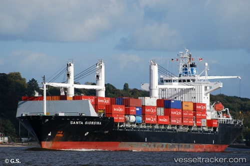
Cielo Di Rabat
Current StatusWhere is the vessel?
Cielo Di Rabat is currently in Near Casablanca, based on AIS data received less than 1h ago.
Latest AIS update:
Current position: 33.64803° N, 7.60823° W (Near Casablanca)
Average speed (last 7 days): Loading…
Average speed (last 30 days): Loading…
Vessel profile: Cielo Di Rabat is a Container Ship with dimensions 30m x 182m.
This page combines live AIS, route history, probable destination signals, nearby traffic, and port activity for practical vessel monitoring.
The current position of vessel Cielo Di Rabat is 33.64803 lat / -7.60823 lng. Updated: 2026-04-02 03:42:03 UTCNearest reference points:
- Near Mohammedia
- Near Jorf Lasfar
- 54 nm N of El Jadida
Details:
Live Vessel Cielo Di Rabat Analytics (details, animations, etc.)
Recent AIS points (UTC):
2026-04-01 21:39:00 UTC · 33.64747, -7.60966 · SOG 0.2 kn · COG 6°2026-04-02 00:03:01 UTC · 33.64763, -7.60884 · SOG 0.1 kn · COG 341°
2026-04-02 02:18:03 UTC · 33.64792, -7.60836 · SOG 0 kn · COG 321°
2026-04-02 03:42:03 UTC · 33.64803, -7.60823 · SOG 0.2 kn · COG 312°