 vesseltracker.com
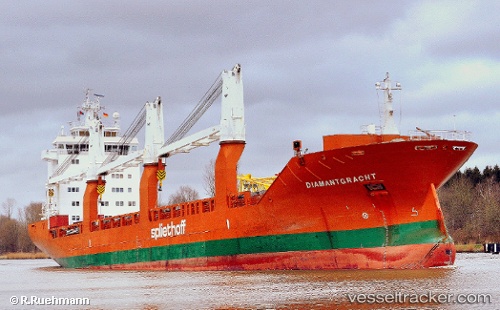
 Diamantgracht
Current Status
Where is the vessel?
Diamantgracht is currently in 24 nm NW of ALDERNEY, based on AIS data received about 2h ago.
Latest AIS update:
Current position: 50.05200° N, 2.55264° W (24 nm NW of ALDERNEY)
Average speed (last 7 days): Loading…
Average speed (last 30 days): Loading…
Vessel profile: Diamantgracht is a General Cargo Ship with dimensions 157m x 157m.
This page combines live AIS, route history, probable destination signals, nearby traffic, and port activity for practical vessel monitoring.
The current position of vessel Diamantgracht is 50.05200 lat / -2.55264 lng. Updated: 2026-04-02 16:08:24 UTCNearest reference points:
- 23 nm NW of Saint Sampson
- Near ALDERNEY
- Near Castletown
Currently sailing under the flag of Netherlands ![]()
Diamantgracht built in 2009 year
Deadweight:
17966 tDetails:
Live Vessel Diamantgracht Analytics (details, animations, etc.)
Recent AIS points (UTC):
2026-04-02 10:10:16 UTC · 50.42292, -0.41525 · SOG 10.5 kn · COG 255°2026-04-02 11:27:08 UTC · 50.36328, -0.77649 · SOG 11.8 kn · COG 255°
2026-04-02 13:22:12 UTC · 50.25514, -1.42733 · SOG 15.3 kn · COG -1°
2026-04-02 16:08:24 UTC · 50.05200, -2.55264 · SOG 13.4 kn · COG 256°