 vesseltracker.com
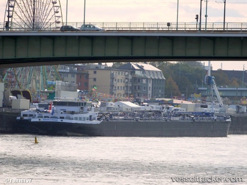
 Amistade
Current Status
Where is the vessel?
Amistade is currently in Near Maassluis, based on AIS data received less than 1h ago.
Latest AIS update:
Current position: 51.92175° N, 4.21826° E (Near Maassluis)
Average speed (last 7 days): Loading…
Average speed (last 30 days): Loading…
Vessel profile: Amistade is a Oil And Chemical Tank Barge with dimensions 136m x 16m.
This page combines live AIS, route history, probable destination signals, nearby traffic, and port activity for practical vessel monitoring.
The current position of vessel Amistade is 51.92175 lat / 4.21826 lng. Updated: 2026-04-12 15:29:02 UTCNearest reference points:
- Near Maassluis
- Near BRIELLE
- Near Zwartewaal
Currently sailing under the flag of Netherlands ![]()
Details:
Live Vessel Amistade Analytics (details, animations, etc.)
Recent AIS points (UTC):
2026-04-12 10:47:03 UTC · 51.92175, 4.21825 · SOG 0 kn · COG -1°2026-04-12 11:53:08 UTC · 51.92173, 4.21826 · SOG 0 kn · COG -1°
2026-04-12 13:26:02 UTC · 51.92175, 4.21826 · SOG 0 kn · COG -1°
2026-04-12 15:29:02 UTC · 51.92175, 4.21826 · SOG 0 kn · COG -1°