 vesseltracker.com
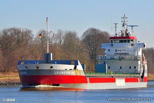
 Lauwersborg
Current Status
Where is the vessel?
Lauwersborg is currently in Near Town Quays/Drogheda, based on AIS data received about 3h ago.
Latest AIS update:
Current position: 53.74920° N, 6.48674° E (Near Town Quays/Drogheda)
Average speed (last 7 days): Loading…
Average speed (last 30 days): Loading…
Vessel profile: Lauwersborg is a Multi Purpose Carrier with dimensions 123m x 14m.
This page combines live AIS, route history, probable destination signals, nearby traffic, and port activity for practical vessel monitoring.
The current position of vessel Lauwersborg is 53.74920 lat / 6.48674 lng. Updated: 2026-03-28 19:35:34 UTCNearest reference points:
- Near Borkum
- 14 nm NW of Town Quays/Drogheda
- Near Hoogkerk
Currently sailing under the flag of Netherlands ![]()
Lauwersborg built in 2007 year
Deadweight:
7350 tDetails:
Live Vessel Lauwersborg Analytics (details, animations, etc.)
Recent AIS points (UTC):
2026-03-28 14:01:35 UTC · 53.48946, 5.08388 · SOG 10.8 kn · COG 72°2026-03-28 15:46:35 UTC · 53.58026, 5.57678 · SOG 10.2 kn · COG 71°
2026-03-28 17:47:14 UTC · 53.68134, 6.11046 · SOG 9.6 kn · COG 72°
2026-03-28 19:35:34 UTC · 53.74920, 6.48674 · SOG 7.1 kn · COG 76°