 vesseltracker.com
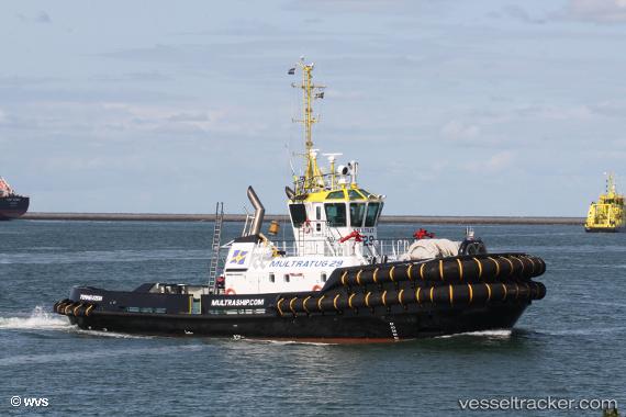
 Multratug 29
Current Status
Where is the vessel?
Multratug 29 is currently in Near Nieuwdorp, based on AIS data received about 1h ago.
Latest AIS update:
Current position: 51.46247° N, 3.70142° E (Near Nieuwdorp)
Average speed (last 7 days): Loading…
Average speed (last 30 days): Loading…
Vessel profile: Multratug 29 is a Tug with dimensions 32m x 12m.
This page combines live AIS, route history, probable destination signals, nearby traffic, and port activity for practical vessel monitoring.
The current position of vessel Multratug 29 is 51.46247 lat / 3.70142 lng. Updated: 2026-04-04 03:24:02 UTCNearest reference points:
- Near Nieuwdorp
- Near Borssele
- Near BASTIAAN DE LANGEPLA
Currently sailing under the flag of Netherlands ![]()
Details:
Live Vessel Multratug 29 Analytics (details, animations, etc.)
Recent AIS points (UTC):
2026-04-03 22:20:57 UTC · 51.46248, 3.70140 · SOG 0 kn · COG 57°2026-04-04 00:21:01 UTC · 51.46247, 3.70143 · SOG 0 kn · COG 58°
2026-04-04 01:48:03 UTC · 51.46248, 3.70142 · SOG 0 kn · COG 58°
2026-04-04 03:24:02 UTC · 51.46247, 3.70142 · SOG 0 kn · COG 58°