 vesseltracker.com
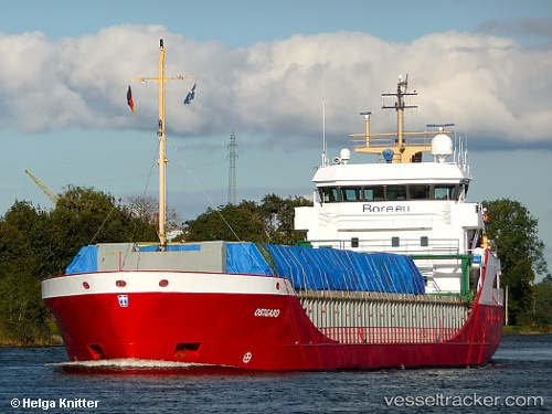
 Ostborg
Current Status
Where is the vessel?
Ostborg is currently in 15 nm NE of Town Quays/Drogheda, based on AIS data received less than 1h ago.
Latest AIS update:
Current position: 53.88296° N, 6.66524° E (15 nm NE of Town Quays/Drogheda)
Average speed (last 7 days): Loading…
Average speed (last 30 days): Loading…
Vessel profile: Ostborg is a Multi Purpose Carrier with dimensions 89m x 12m.
This page combines live AIS, route history, probable destination signals, nearby traffic, and port activity for practical vessel monitoring.
The current position of vessel Ostborg is 53.88296 lat / 6.66524 lng. Updated: 2026-04-14 15:50:05 UTCNearest reference points:
- Near Borkum
- Near NORDERNEY
- Near NORDDEICH
Currently sailing under the flag of Netherlands ![]()
Ostborg built in 2001 year
Deadweight:
3792 tDetails:
Live Vessel Ostborg Analytics (details, animations, etc.)
Recent AIS points (UTC):
2026-04-14 10:09:44 UTC · 53.98385, 8.42788 · SOG 11.2 kn · COG 283°2026-04-14 11:48:24 UTC · 54.02318, 7.91960 · SOG 11.8 kn · COG 277°
2026-04-14 13:38:24 UTC · 53.97890, 7.33202 · SOG 11.4 kn · COG 255°
2026-04-14 15:50:05 UTC · 53.88296, 6.66524 · SOG 10 kn · COG 258°