 vesseltracker.com
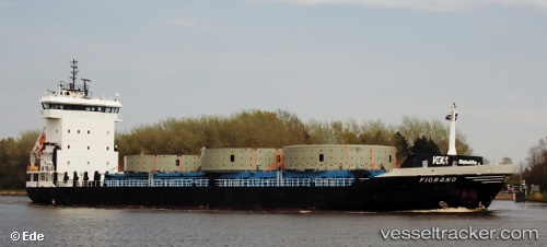
Somers Isles
Current StatusWhere is the vessel?
Somers Isles is currently in Near Fernandina, based on AIS data received less than 1h ago.
Latest AIS update:
Current position: 30.67702° N, 81.46486° W (Near Fernandina)
Average speed (last 7 days): Loading…
Average speed (last 30 days): Loading…
Vessel profile: Somers Isles is a Multi Purpose Carrier with dimensions 16m x 100m.
This page combines live AIS, route history, probable destination signals, nearby traffic, and port activity for practical vessel monitoring.
The current position of vessel Somers Isles is 30.67702 lat / -81.46486 lng. Updated: 2026-04-02 03:35:07 UTCNearest reference points:
- Near Fernandina
- Near Jacksonville
- Near Brunswick
Details:
Live Vessel Somers Isles Analytics (details, animations, etc.)
Recent AIS points (UTC):
2026-04-01 21:41:06 UTC · 30.67702, -81.46488 · SOG 0 kn · COG 27°2026-04-01 23:53:09 UTC · 30.67667, -81.46333 · SOG 0 kn · COG -1°
2026-04-02 01:29:07 UTC · 30.67693, -81.46486 · SOG 0 kn · COG 27°
2026-04-02 03:35:07 UTC · 30.67702, -81.46486 · SOG 0 kn · COG 27°