 vesseltracker.com
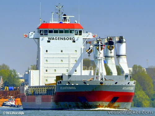
Atlanticborg
Current StatusWhere is the vessel?
Atlanticborg is currently in Near Sheerness, based on AIS data received about 1h ago.
Latest AIS update:
Current position: 51.44347° N, 0.74343° E (Near Sheerness)
Average speed (last 7 days): Loading…
Average speed (last 30 days): Loading…
Vessel profile: Atlanticborg is a General Cargo Ship with dimensions 22m x 143m.
This page combines live AIS, route history, probable destination signals, nearby traffic, and port activity for practical vessel monitoring.
The current position of vessel Atlanticborg is 51.44347 lat / 0.74343 lng. Updated: 2026-04-21 11:22:29 UTCNearest reference points:
- Near GILLINGHAM
- Near BURNHAM ON CROUCH
- Near HEYBRIDGE
Details:
Live Vessel Atlanticborg Analytics (details, animations, etc.)
Recent AIS points (UTC):
2026-04-21 07:55:28 UTC · 51.44345, 0.74341 · SOG 0 kn · COG 354°2026-04-21 07:58:28 UTC · 51.44345, 0.74341 · SOG 0 kn · COG 354°
2026-04-21 09:40:29 UTC · 51.44347, 0.74344 · SOG 0 kn · COG 354°
2026-04-21 11:22:29 UTC · 51.44347, 0.74343 · SOG 0 kn · COG 354°