 vesseltracker.com
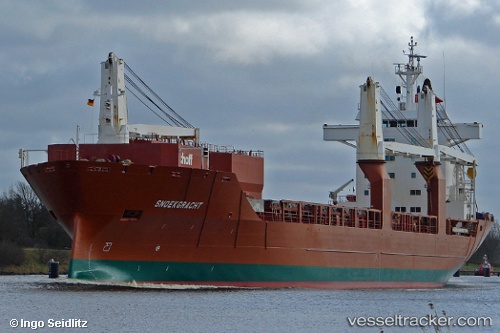
 Snoekgracht
Current Status
Where is the vessel?
Snoekgracht is currently in 73 nm SW of Boboras, based on AIS data received about 2h ago.
Latest AIS update:
Current position: 45.66155° N, 9.47174° W (73 nm SW of Boboras)
Average speed (last 7 days): Loading…
Average speed (last 30 days): Loading…
Vessel profile: Snoekgracht is a General Cargo Ship with dimensions 168m x 168m.
This page combines live AIS, route history, probable destination signals, nearby traffic, and port activity for practical vessel monitoring.
The current position of vessel Snoekgracht is 45.66155 lat / -9.47174 lng. Updated: 2026-04-13 16:21:37 UTCNearest reference points:
- 57 nm S of Boboras
- 30 nm NW of Meiras-Valdoviño
- 13 nm NE of Villanueva de Lorenzana
Currently sailing under the flag of Netherlands ![]()
Snoekgracht built in 2000 year
Deadweight:
21402 tDetails:
Live Vessel Snoekgracht Analytics (details, animations, etc.)
Recent AIS points (UTC):
2026-04-13 11:52:21 UTC · 46.63263, -8.56965 · SOG 15.4 kn · COG 215°2026-04-13 11:52:21 UTC · 46.63263, -8.56965 · SOG 15.4 kn · COG 215°
2026-04-13 14:06:49 UTC · 46.15308, -9.02682 · SOG 15.9 kn · COG 215°
2026-04-13 16:21:37 UTC · 45.66155, -9.47174 · SOG 15.3 kn · COG 213°