 vesseltracker.com
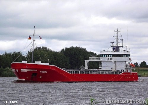
Robijn
Current StatusWhere is the vessel?
Robijn is currently in 24 nm SE of Covent Garden, based on AIS data received less than 1h ago.
Latest AIS update:
Current position: 51.22991° N, 7.51774° W (24 nm SE of Covent Garden)
Average speed (last 7 days): Loading…
Average speed (last 30 days): Loading…
Vessel profile: Robijn is a General Cargo Ship with dimensions 13m x 90m.
This page combines live AIS, route history, probable destination signals, nearby traffic, and port activity for practical vessel monitoring.
The current position of vessel Robijn is 51.22991 lat / -7.51774 lng. Updated: 2026-04-09 19:21:02 UTCNearest reference points:
- 45 nm SE of Covent Garden
- Near Covent Garden
- Near Cobn
Details:
Live Vessel Robijn Analytics (details, animations, etc.)
Recent AIS points (UTC):
2026-04-09 13:48:25 UTC · 51.83422, -8.27037 · SOG 0.2 kn · COG 311°2026-04-09 15:33:02 UTC · 51.72518, -8.26468 · SOG 11.3 kn · COG 180°
2026-04-09 18:17:42 UTC · 51.36169, -7.73622 · SOG 10.6 kn · COG 134°
2026-04-09 19:21:02 UTC · 51.22991, -7.51774 · SOG 11 kn · COG 138°