 vesseltracker.com
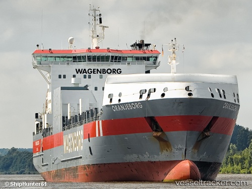
Oranjeborg
Current StatusWhere is the vessel?
Oranjeborg is currently in 11 nm NW of Saint-Anaclet, based on AIS data received about 1h ago.
Latest AIS update:
Current position: 48.64393° N, 68.55153° W (11 nm NW of Saint-Anaclet)
Average speed (last 7 days): Loading…
Average speed (last 30 days): Loading…
Vessel profile: Oranjeborg is a Ro Ro Cargo Ship with dimensions 26m x 158m.
This page combines live AIS, route history, probable destination signals, nearby traffic, and port activity for practical vessel monitoring.
The current position of vessel Oranjeborg is 48.64393 lat / -68.55153 lng. Updated: 2026-04-18 17:48:43 UTCNearest reference points:
- 15 nm NW of Saint-Anaclet
- Near Ile Aux Coudres
- 22 nm N of Sainte-Anne-des-Monts
Details:
Live Vessel Oranjeborg Analytics (details, animations, etc.)
Recent AIS points (UTC):
2026-04-18 11:43:56 UTC · 47.71427, -69.91657 · SOG 15.4 kn · COG 42°2026-04-18 13:57:02 UTC · 48.25769, -69.44446 · SOG 14.2 kn · COG 25°
2026-04-18 16:17:34 UTC · 48.47935, -68.91239 · SOG 11.4 kn · COG 56°
2026-04-18 17:48:43 UTC · 48.64393, -68.55153 · SOG 11.5 kn · COG 54°