 vesseltracker.com
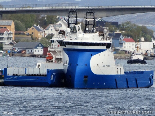
 KINGSBORG
Current Status
Where is the vessel?
KINGSBORG is currently in 44 nm W of Neeltje Jans, based on AIS data received less than 1h ago.
Latest AIS update:
Current position: 53.36294° N, 2.56940° E (44 nm W of Neeltje Jans)
Average speed (last 7 days): Loading…
Average speed (last 30 days): Loading…
Vessel profile: KINGSBORG is a Offshore Supply Ship with dimensions m x m.
This page combines live AIS, route history, probable destination signals, nearby traffic, and port activity for practical vessel monitoring.
The current position of vessel KINGSBORG is 53.36294 lat / 2.56940 lng. Updated: 2026-04-23 01:29:01 UTCNearest reference points:
- 48 nm NE of Somersby
- 24 nm NE of Caister on Sea
- 19 nm NW of Neeltje Jans
Currently sailing under the flag of Netherlands ![]()
Details:
Live Vessel KINGSBORG Analytics (details, animations, etc.)
Recent AIS points (UTC):
2026-04-22 22:03:30 UTC · 53.36273, 2.56932 · SOG 0.2 kn · COG 43°2026-04-23 00:14:19 UTC · 53.36281, 2.56956 · SOG 0.2 kn · COG 41°
2026-04-23 01:10:13 UTC · 53.36286, 2.56952 · SOG 0.3 kn · COG 39°
2026-04-23 01:29:01 UTC · 53.36294, 2.56940 · SOG 0.1 kn · COG 40°