 vesseltracker.com
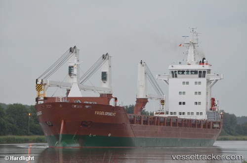
 Fagelgracht
Current Status
Where is the vessel?
Fagelgracht is currently in 38 nm E of Fisher Island, Miami, based on AIS data received less than 1h ago.
Latest AIS update:
Current position: 25.57695° N, 79.47131° W (38 nm E of Fisher Island, Miami)
Average speed (last 7 days): Loading…
Average speed (last 30 days): Loading…
Vessel profile: Fagelgracht is a General Cargo Ship with dimensions 136m x 136m.
This page combines live AIS, route history, probable destination signals, nearby traffic, and port activity for practical vessel monitoring.
The current position of vessel Fagelgracht is 25.57695 lat / -79.47131 lng. Updated: 2026-04-17 02:29:11 UTCNearest reference points:
- 44 nm E of Surfside
- 44 nm S of Freeport
- Near Fisher Island, Miami
Currently sailing under the flag of Netherlands ![]()
Fagelgracht built in 2011 year
Deadweight:
12500 tDetails:
Live Vessel Fagelgracht Analytics (details, animations, etc.)
Recent AIS points (UTC):
2026-04-16 20:15:06 UTC · 26.11077, -78.52797 · SOG 13.8 kn · COG -1°2026-04-16 22:03:08 UTC · 26.19920, -78.99412 · SOG 14.8 kn · COG 277°
2026-04-17 00:17:01 UTC · 26.06941, -79.45051 · SOG 13.2 kn · COG 180°
2026-04-17 02:29:11 UTC · 25.57695, -79.47131 · SOG 14.3 kn · COG 183°