 vesseltracker.com
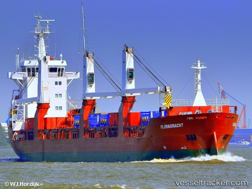
Floragracht
Current StatusWhere is the vessel?
Floragracht is currently in 13 nm NW of Curtis Island, based on AIS data received about 1h ago.
Latest AIS update:
Current position: 23.39336° S, 151.02901° E (13 nm NW of Curtis Island)
Average speed (last 7 days): Loading…
Average speed (last 30 days): Loading…
Vessel profile: Floragracht is a General Cargo Ship with dimensions 19m x 137m.
This page combines live AIS, route history, probable destination signals, nearby traffic, and port activity for practical vessel monitoring.
The current position of vessel Floragracht is -23.39336 lat / 151.02901 lng. Updated: 2026-04-17 01:33:11 UTCNearest reference points:
- Near ROSSLYN
- Near Gladstone Harbor
- Near Boyne Island
Details:
Live Vessel Floragracht Analytics (details, animations, etc.)
Recent AIS points (UTC):
2026-04-16 19:26:52 UTC · -23.26923, 151.19991 · SOG 9.2 kn · COG 209°2026-04-16 22:00:13 UTC · -23.39341, 151.02545 · SOG 0 kn · COG 106°
2026-04-16 23:30:16 UTC · -23.39259, 151.02599 · SOG 0 kn · COG 142°
2026-04-17 01:33:11 UTC · -23.39336, 151.02901 · SOG 0 kn · COG 237°