 vesseltracker.com
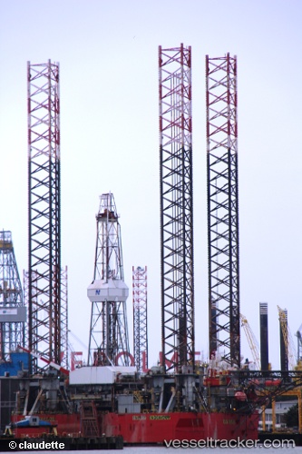
 ERDA
ERDA
Current Status
Where is the vessel?
ERDA is currently in 37 nm NW of Town Quays/Drogheda, based on AIS data received less than 1h ago.
Latest AIS update:
Current position: 54.04931° N, 5.43709° E (37 nm NW of Town Quays/Drogheda)
Average speed (last 7 days): Loading…
Average speed (last 30 days): Loading…
Vessel profile: ERDA is a Drilling Jack Up with dimensions m x m.
This page combines live AIS, route history, probable destination signals, nearby traffic, and port activity for practical vessel monitoring.
The current position of vessel ERDA is 54.04931 lat / 5.43709 lng. Updated: 2026-04-14 03:53:32 UTCNearest reference points:
- 14 nm NW of Town Quays/Drogheda
- Near HARLINGEN
- Near FRANEKER
Currently sailing under the flag of Netherlands ![]()
Details:
Live Vessel ERDA Analytics (details, animations, etc.)
Recent AIS points (UTC):
2026-04-13 21:32:26 UTC · 54.04932, 5.43711 · SOG 0 kn · COG -1°2026-04-14 00:18:24 UTC · 54.04833, 5.43667 · SOG 0 kn · COG -1°
2026-04-14 02:18:20 UTC · 54.04925, 5.43704 · SOG 0 kn · COG -1°
2026-04-14 03:53:32 UTC · 54.04931, 5.43709 · SOG 0 kn · COG -1°