 vesseltracker.com
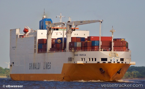
 Grande Francia
Current Status
Where is the vessel?
Grande Francia is currently in 73 nm NW of Ad Dakhla, based on AIS data received less than 1h ago.
Latest AIS update:
Current position: 24.75634° N, 16.59950° W (73 nm NW of Ad Dakhla)
Average speed (last 7 days): Loading…
Average speed (last 30 days): Loading…
Vessel profile: Grande Francia is a Vehicles Carrier with dimensions 214m x 32m.
This page combines live AIS, route history, probable destination signals, nearby traffic, and port activity for practical vessel monitoring.
The current position of vessel Grande Francia is 24.75634 lat / -16.59950 lng. Updated: 2026-04-18 20:17:54 UTCNearest reference points:
- 68 nm NW of Ad Dakhla
- 110 nm NE of Las Brujas
- Near DAKHLA
Currently sailing under the flag of Italy ![]()
Grande Francia built in 2002 year
Deadweight:
26169 tDetails:
Live Vessel Grande Francia Analytics (details, animations, etc.)
Recent AIS points (UTC):
2026-04-18 13:25:06 UTC · 26.27687, -15.35906 · SOG 16.5 kn · COG 220°2026-04-18 15:16:30 UTC · 25.88367, -15.73119 · SOG 16.5 kn · COG -1°
2026-04-18 17:25:24 UTC · 25.44037, -16.17207 · SOG 16.6 kn · COG 220°
2026-04-18 20:17:54 UTC · 24.75634, -16.59950 · SOG 16.9 kn · COG 202°